|
May 15th, 2013
Friends of MacDonald tend the flame of a great 19th century adventurer
Posted: Tuesday, May 14, 2013 9:11 a, Daily Astorian
In the pantheon of 19th century adventurers, Ranald MacDonald’s story is one of the more astounding. Born at Fort Astoria in 1824, MacDonald was the child of a Scotsman and a Chinook Indian princess, daughter of Chief Comcomly. He went to sea on a whaling vessel, with the intention to be shipwrecked in Japan, which had excluded foreigners for some 200 years. MacDonald’s plan worked, and he brought the English language to Japan.
Writing in Eminent Astorians, Frederik L. Schodt says MacDonald: “ … is a classic example of an individual who, overcoming great odds, did something heroic then fell through the cracks of history.”
Over lunch last Saturday at the Bridgewater Bistro, the Friends of MacDonald held its 25th annual meeting. The Friends group had its genesis following the 1988 placement of a memorial stone at Fort Astoria park. On that marker, MacDonald’s story is told in English and Japanese. Local leadership from then-Astoria librarian Bruce Berney and Japanese money were the winning combination.
The Japanese make a bigger deal of MacDonald than we Americans. A woman from Kyoto traveled to the Friends of MacDonald lunch, as did the Japanese Consul from Portland.
It is said that through biography we give life to the dead. Reminding Astorians that a story of global accomplishment began here is important. The Friends’ gathering reminds us that the Columbia-Pacific region has long been a cultural crossroads.
Cities are living things. They are in a constant cycle of deterioration, death and renewal. And they have memories.
Posted in Gates Ajar, Home | Comments Off on Editorial: Astoria has a long memory
February 10th, 2013
The “Daily Souya” newspaper, dated Dec. 11, 2012, reports that a scholarship fund named “MacDonald’s Encouragement Study Fund” has been established on Rishiri Island. A committee to support and manage the Fund has also been formed with Mr. Kyoji Furukawa as its first President. Since the beginning of 2012 the leaders of Rishiri Island held a series of meetings intended to get the ground work done for devising a scholarship fund which would benefit the students of the only public high school on the island and in particular to encourage them to study English. One or two top students will be chosen from the English-language class and will be sent to America – to Oregon and/or Washington – to experience American life and to further encourage their English language skills. The program hopes to nurture the type of “internationally-minded person” who will become a human asset to Rishiri Island and will help to sustain the prosperous and happy life-style of Rishiri Island. Committee members hope that this program will encourage more students to attend Rishiri Public High School [whose student body is in decline]. We at Friends of MacDonald happily and enthusiastically go “on record” in fully supporting the “MacDonald’s Encouragement Study Fund” and it’s exchange program.
For those of you who are interested in assisting this fledgling program by either donating funds or hosting a student from Rishiri – or both – please contact Friends of MacDonald at amm@friendsofmacdonald.com .
Posted in FOM Japan, Gates Ajar, Home | Comments Off on MacDonald Scholarship Established on Rishiri
January 9th, 2013
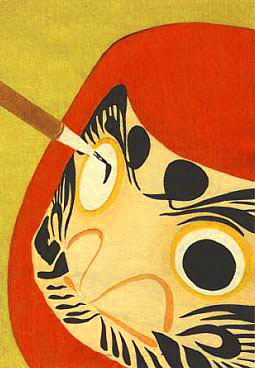
“Nanakorobi Yaoki” is translated to mean “seven times down, eight times up” — another way to say “never give up hope”.
The Daruma is a traditional Japanese doll modeled after Bodhi Dharma, the founder of the Zen sect of Buddhism. Daruma has a design that is rich in symbolism and is regarded as a talisman of good luck to the Japanese. These ‘dolls’ are seen as a symbol of perseverance and good luck, making them a popular gift of encouragement. They are usually made of papier-mâché, have a round shape, are hollow, and weighted at the bottom in a way that each doll will always return to an upright position when tipped over. This characteristic has come to symbolize the ability to have success, overcome adversity, and recover from misfortune. Due to this, Daruma is often illustrated alongside the phrase “Nanakorobi Yaoki”, translated to mean “seven times down, eight times up”, another way to say “never give up hope”. The eyes of Daruma are often blank when sold. The recipient of the doll fills in one eye upon setting the goal, then the other upon fulfilling it. In this way, every time they see the one-eyed Daruma, they recall the goal.
Knowing what we do about Ranald and his seemingly boundless desire and energy to explore and participate in his world, I can easily imagine that he would have been delighted to have had a Daruma – with all of the projects he managed to document, it’s likely he would have used up several of them in his lifetime. If there is anyone we can think of that epitomized the notion of “try, try again” it definitely was our friend Ranald MacDonald.
Posted in FOM Japan, Gates Ajar, Home | Comments Off on “Nanakorobi Yaoki” ~~ “七転八起” ダルマ精神
August 24th, 2012
Middle Village and Station Camp open house ceremony attracts crowd
By REBECCA SEDLAK
Reprinted with permission from The Daily Astorian of Astoria, Oregon
McGOWAN, Wash. — Middle Village and Station Camp Park held its grand opening Saturday after more than a decade of planning and collaboration.
The park is part of the National Park Service’s Washington expansion of the Lewis and Clark National Historical Park. Located between the north end of the Astoria Bridge and Chinook, Wash., along U.S. Highway 101, the park has been in the works since 2002, during the preparation of the Lewis and Clark Expedition’s Bicentennial.
“For some of us, it’s a miracle that it’s happening,” said Jim Sayce, the Middle Village and Station Camp project liaison with the Washington State Historical Society. “To build a park in the middle of a recession is just amazing. It just tells you that there are things worth doing. This is for the future. This has incredible worth across cultural lines.”
The project is the result of a partnership between the Chinook Indian Nation, the Washington State Historical Society, the McGowan–Garvin family, the National Park Service, the Washington State Parks and Recreation Commission and the Washington State Department of Transportation.
“We all had to stick together and get to know each other really well to get here. It’s so satisfying when you cross the line hand-in-hand with a bunch of other people,” David Szymanski, superintendent of Lewis and Clark National Historical Park, said of the partnership.
The park and its dedication
Saturday’s dedication began with a traditional Chinookan blessing given by Sam Robinson, vice chairman of the Chinook Nation. Numerous dignitaries and project partners gave short speeches in honor of the opening.
The 280-acre park features several lookout points to view the Columbia River, 2,400 feet of walking paths, three concrete canoe sculptures for children to play in, an unfinished traditional Chinook Indian plank house and numerous exhibits. Plans include connecting the trails to Fort Columbia and installing traditional Chinookan artwork.
“To me the Middle Village/Station Camp project represents the best of two worlds,” said Jennifer Kilmer, director of the Washington State Historical Society. “Through interpretive panels and exhibit-like structures we have the educational aspects of a great museum. Through its sweeping views of the Columbia River, walking paths and recreated beaches, we have the elements of a beautiful recreational experience. The combined experience is truly special.”
The Washington State Historical Society awarded Ray Gardner, chairman of the Chinook Nation, its Peace and Friendship Award during the ceremony.
The dedication ended with the cutting of an elk-hide leather rope to declare the park officially open. Afterward, the Pacific County Friends of Lewis and Clark hosted a reception in the Chinook School gymnasium.
Other attendees of Saturday’s dedication included David Nicandri, past director of the Washington State Historical Society; Karen Snyder, chairwoman of the Pacific County Friends of Lewis and Clark; Carolyn Glenn, the co-chairwoman of the Pacific County Friends of Lewis and Clark; Brian Baird, the former U.S. representative who represented the 3rd District; state Rep. Dean Takko, who represents the 19th district; state Sen. Brian Hatfield, who represents the 19th district; Sid Snyder, the former state senator who represented the 19th District; Bob Andrew, mayor of the city of Long Beach; Dale Jacobson, former mayor of the city of Long Beach; Schuyler Hoss, a representative from Gov. Christine Gregoire’s office; David Hodges, a representative from U.S. Sen. Patty Murray’s office; Kimberly Pincheira, a representative from U.S. Sen. Maria Cantwell’s office; Chip Jenkins, the superintendent for North Cascades National Park who was at Fort Clatsop during the bicentennial; Christine Lehnertz, the pacific west regional director of the National Park Service; other National Park Service staff; other members of the Chinook Nation; members of the McGowan-Garvin family; and representatives from the Washington State Department of Transportation..
The history of the site
“This is a place that has many stories, many meanings, and is important to many people for many different reasons,” Gardner said.
The Chinook people occupied the site for thousands of years.
“Our people, the Chinook people, were here to meet every new person who came into the area,” Gardner said.
When Capt. Robert Gray successfully entered the Columbia River in 1792, he traded with the Chinook. In the next 13 years almost 90 ships from Europe and America crossed the Columbia River Bar to trade.
The Lewis and Clark Expedition spent 10 days at Middle Village in November 1805. The Chinook had moved to their winter village, so the site was unoccupied. The short visit is where the term “Station Camp” comes from: William Clark used it as a survey station to create a map of the mouth of the Columbia River, the most detailed and accurate map produced during the expedition. The Corps of Discovery voted on Nov. 24, 1805 to find a winter camp on the south side of the river – a vote that included the Lemhi Shoshone woman Sacajawea and the African-American York.
The site continued to play an important role in trade in the lower Columbia Region until 1820.
“I don’t think there’s any site more significant than this one,” Szymanski said. “It’s a place where the world changed over 30 years; it changed dramatically.
“Archaeology and history tell us that we had one of the most sophisticated pre-contact cultures in North America here along this river. That’s gone. And we want people to know it was here.”
In 1848 a Catholic Mission was built at the site and later abandoned.
Oregon pioneer Patrick J. McGowan purchased the mission grant and 320 acres of land in 1853. He established a cannery and a small community. In 1904, McGowan donated land for St. Mary’s Catholic Church, which was built on the station camp site and now lies within the park.
“This place forces you to think about the past,” Bill Garvin, a descendent of McGowan, said at the ceremony Saturday. “What happened here was both uplifting and catastrophic. It’s one of those rare intersections where cultures collided.”
Only two families have owned the Middle Village and Station Camp Park site: the Chinook people and the McGowan-Garvin family.
“There have been visitors,” Gardner said. “There are people that have come and been here for a few days, and they’ve moved on. But the constant has always been those two families.
“I think all of us, no matter who we descended from, we all need to work to honor our ancestors because without them none of us would be here,” Gardner said. “I think we’ve got a place that’s a good beginning. There are more stories to be told here and they will as time goes on.”
Posted in Gates Ajar, Home | Comments Off on New park: ‘It’s a miracle that it’s happening’
May 31st, 2012
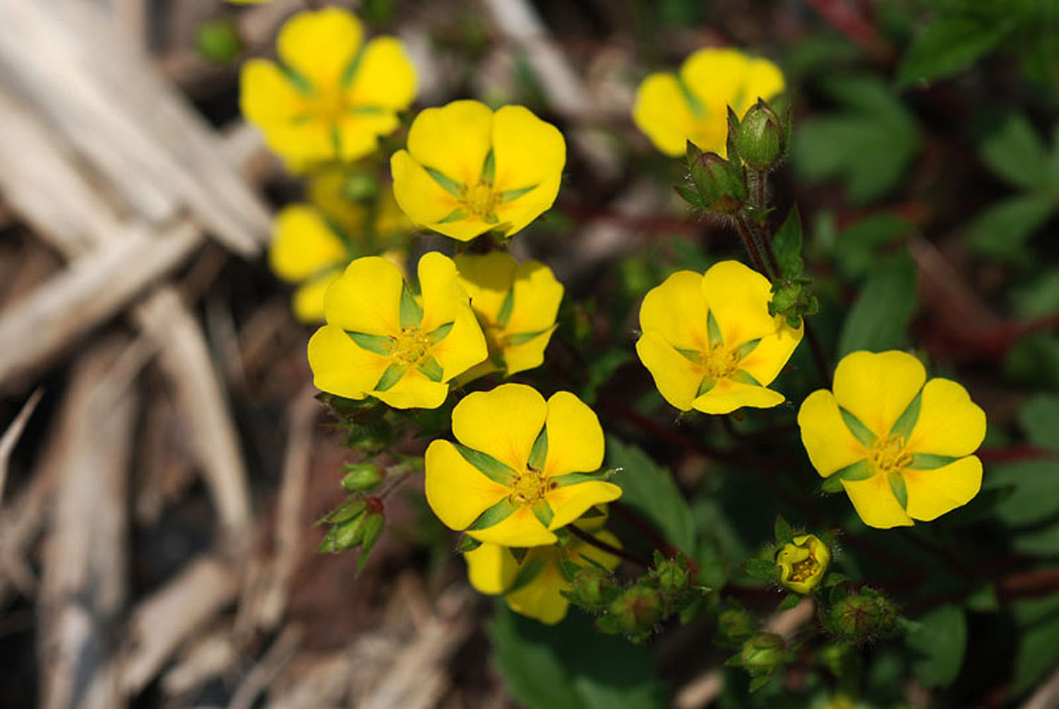 photos by Eiji Nishiya photos by Eiji Nishiya
‘ kijimushiro ‘
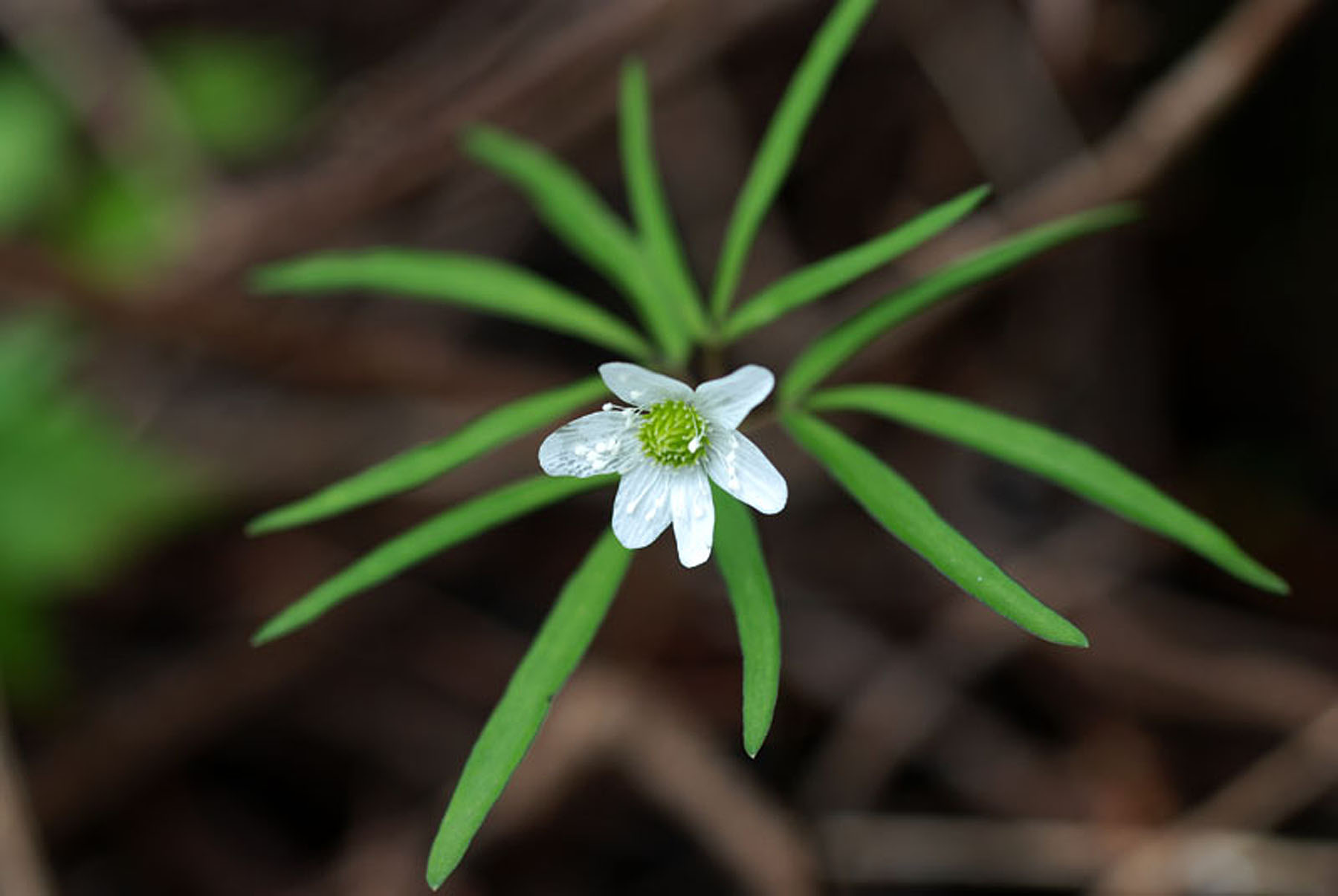
Potentilla fragarioides is a member of the Rosaceae family that is native to China, Japan, Korea, Mongolia, and Russia. The stem is boiled for use as a hemostatic in Traditional Chinese Medicine (TCM). D-Catechin has been isolated as the agent of action, being used to stem bleeding after childbirth.
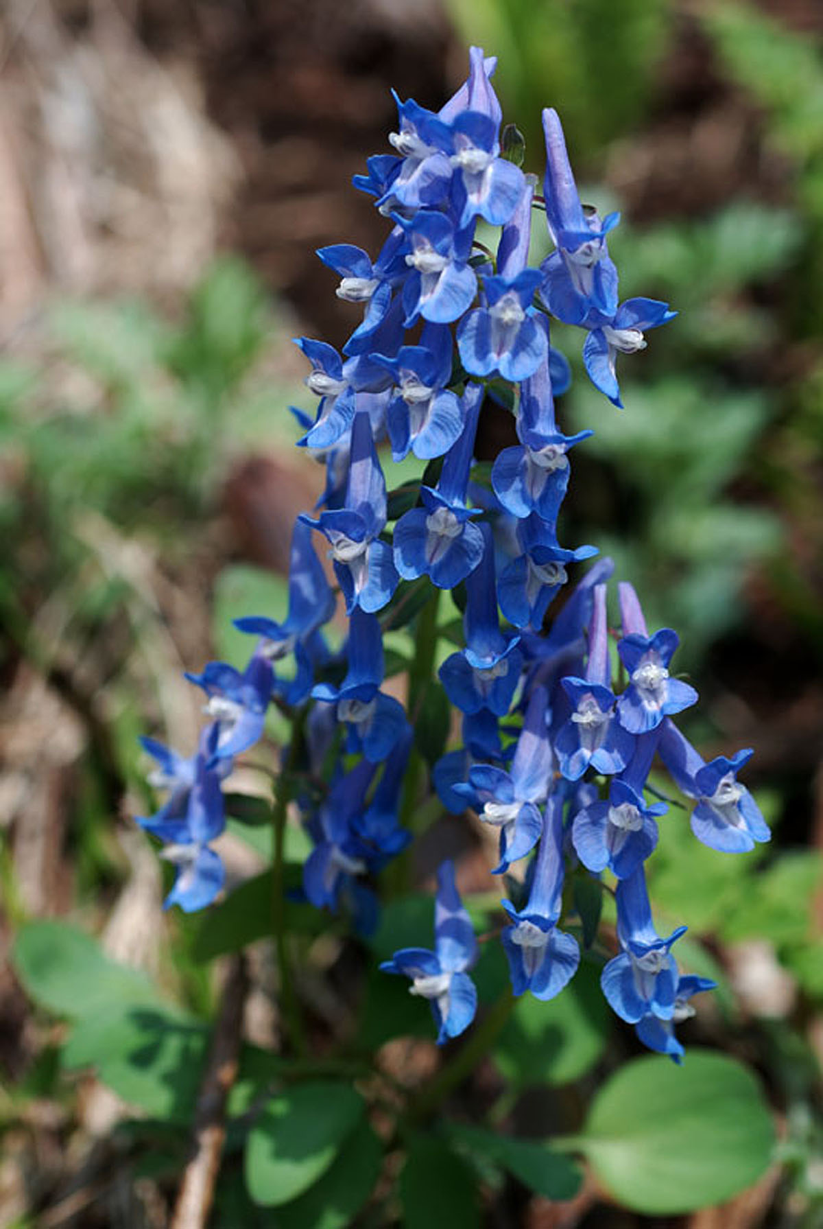
‘ ezo-engosaku ‘
Corydalis ambigua This plant is a perennial herb from the poppy family that grows in the deciduous broad-leaved forest. It blooms from April to May before other taller plants and trees start to bud. An array of colored flowers cover the forest floor in blue, purple, maroon and white. The flowers can be seen from the Maruyama Path leading towards Sapporo city mountain-climbing area, Asahikawa City, Niseko Town, Rishiri Town and many other places in Hokkaido. Chemicals present in Corydalis ambigua have been studied as potential ways to increase pain tolerance and for treating drug addiction. It is one of the 50 traditional herbs used in Chinese medicine.
‘ hime-ichige ‘
Anemone debilis or Anemonoides debilis, sometimes called the European Thimbleweed, probably due to the shape of the seed cluster. These flowers can be really small:
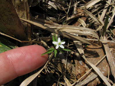 this is tiny! this is tiny!
Posted in FOM Japan, Gates Ajar, Home | Comments Off on Spring Wildflowers of Rishiri Island
April 10th, 2012
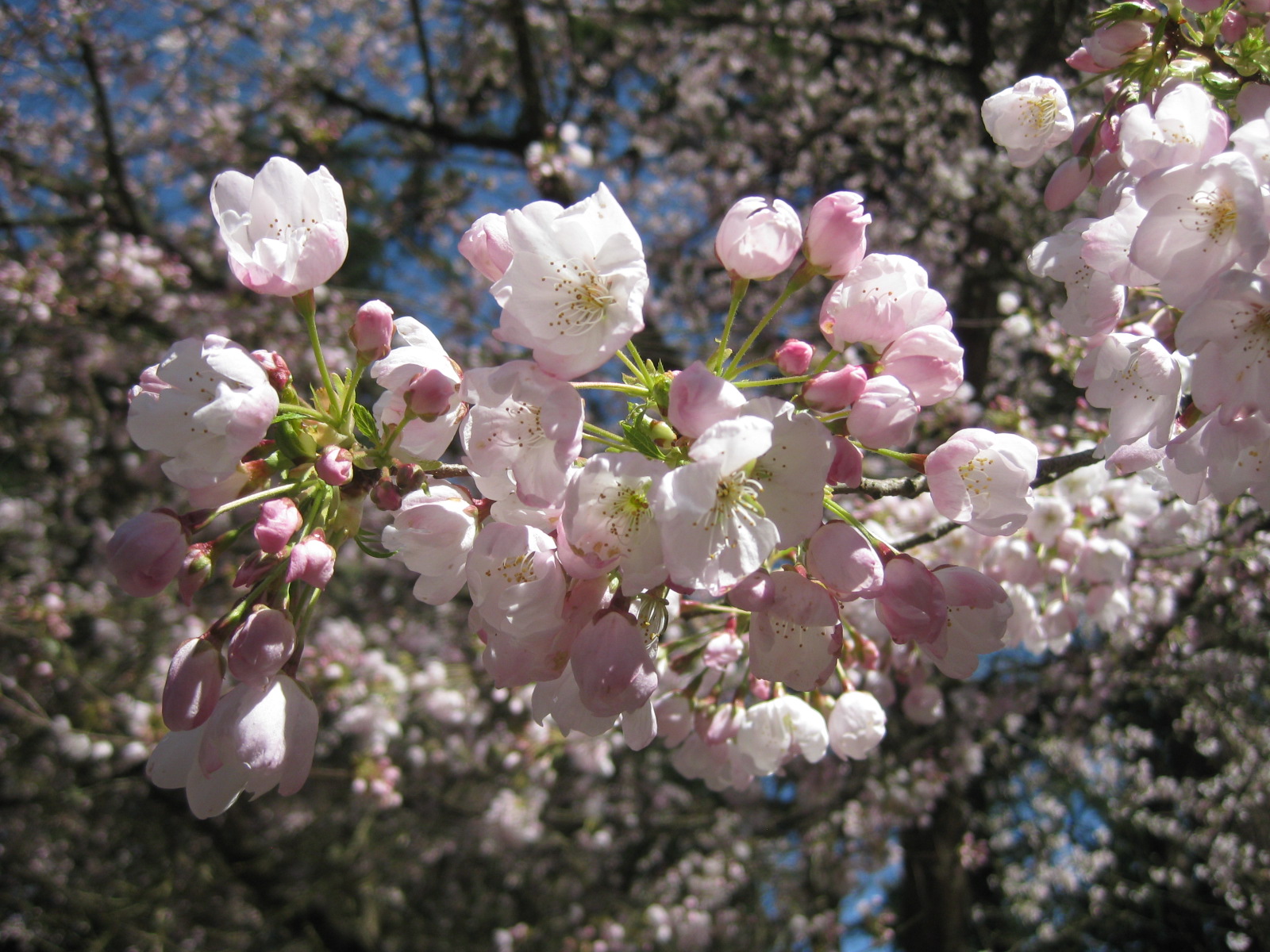
Photo by Mas Yatabe, taken at Portland Japanese Garden
Article By Ichiro Fujisaki, Ambassador of Japan to the United States ~ Reprinted from The Washington Post, January 21, 2012
This spring will mark the 100th anniversary of the chilly day in late March 1912 when two women in heavy coats dug into the earth along the north edge of the Tidal Basin to plant saplings. First lady Helen Taft and Viscountess Iwa Chinda, the wife of the Japanese ambassador to the United States, were joined by just a few people as they helped cherry blossom trees from half a world away take root in the nation’s capital.
When William Howard Taft became president in 1909, neither the Jefferson Memorial nor the Lincoln Memorial had been constructed. Mrs. Taft was hoping to host outdoor concerts and felt that the Tidal Basin area needed some embellishments.
Eliza Scidmore had long awaited such an opportunity. Scidmore, a travel writer, had fallen in love with the cherry blossom trees she saw gracing river banks in Tokyo while she visited her brother, a U.S. diplomat, when he lived in Japan. She had been trying for two decades to persuade authorities to plant them in the District.
David Fairchild of the Agriculture Department shared her view. Before the first lady’s project arose, he had imported some seedlings from Japan and given them to D.C. schools. Scidmore and Fairchild thought that the first lady’s project was a golden opportunity and recommended planting Japanese cherry trees. Mrs. Taft, who was familiar with cherry blossoms from visits to Japan, liked the idea and immediately requested the trees be planted. Col. Spencer Cosby was given the task.
At that time, renowned Japanese chemist Jokichi Takamine, who lived in New York, was visiting Washington. He was an advocate of improving U.S.- Japanese relations and was concerned by the hardening atmosphere in the United States toward Japan. Believing that the cherry blossoms could be a bridge between two peoples, Takamine had been working for years to persuade New York authorities to plant cherry trees along the Hudson River.
Takamine heard from his friend Scidmore about the first lady’s idea, and he proposed to donate 2,000 trees from Japan to the project. The Japanese consul general in New York, Kokichi Mizuno, who was also visiting Washington and was at the meeting with Takamine and Scidmore, proposed making the trees an official gift from the mayor of Tokyo, Japan’s capital city. Takamine, as a leader of the Japanese community in New York, agreed, and he went so far as to suggest to other Japanese in New York that, if official funding was not possible, contributions should be made by the leaders themselves.
The first lady welcomed the Japanese initiative. While Mizuno was communicating this situation to headquarters, the Japanese ambassador to the United States, Kogoro Takahira, confirmed the plan with the U.S. Secretary of State and also recommended to Japan’s foreign minister that the trees be an official gift from Tokyo. The Foreign Ministry then formally contacted the city of Tokyo. Mayor Yukio Ozaki, who was thankful for the role the United States had taken preparing negotiations leading to the Treaty of Portsmouth, which ended the Russo-Japanese War, seized this opportunity.
In 1909, he acquired the Tokyo City Council’s consent to donate 2,000 saplings. Transport across the Pacific was made available by Nippon Yusen Line, free of charge. Young trees about 10 feet tall arrived in Washington in January 1910. People were jubilant. The endeavor attracted media attention, including an article by Scidmore in Century magazine about the beauty of the trees. But just as it seemed everything had come together, U.S. Agriculture Department inspectors found that many of the trees were riddled with insects. The trees had to be burned. Ambassador Yasuya Uchida, who was then in Takahira’s post, wrote to Tokyo to defend the measures U.S. officials had taken and strongly recommended another attempt. The city of Tokyo decided, in April 1910, to donate as many as 3,000 specially grown germless saplings. This time the city took charge of the shipping as well. When the four-foot-tall saplings arrived in the District in March 1912, a thorough inspection was conducted. The trees were found to be in excellent condition, free from insects and plant diseases. It was decided that they should be planted at once. Only a few people, including Scidmore and Cosby, were present at the ceremony.
Ozaki visited Washington twice during the spring season. On both occasions, he composed traditional Japanese verses describing his strong attachment to those cherry trees Tokyo had given. His second visit came just five years after World War II, but he was honored in Congress for the gift. One of his poems reads:
“Viewing the cherry blossoms by the Potomac
Enchanted by the moon and appreciating the snow
There I will find the end of my life.”
Today, more than 3,000 trees surround the Tidal Basin, and approximately 100 of them are originals from 1912. When the Cherry Blossom Festival started in 1927, Mrs. Taft was the main guest, along with former first lady Edith Wilson. Just as the Statue of Liberty, a gift from France, has become a symbol of New York, cherry blossoms from Japan have become a symbol of Washington. The trees and their story are a living testament to the friendship between our peoples.
Commemorative Cherry Tree Planting at the Portland Japanese Garden ~
Thursday, April 12 ~ 10 a.m.–noon
Free with admission
In conjunction with the Japan-U.S. Cherry Blossom Festival Centennial and in collaboration with the the Consulate-General of Japan in Portland, the Japanese Garden will present a commemorative cherry tree planting in front of the Heavenly Falls on April 12th, 2012.
Posted in FOM Japan, Gates Ajar, Home | Comments Off on Cherry Blossoms and Friendship
February 4th, 2012
RISHIRI: A Pilgrimage … I want to say right now that I love Rishiri Island. A few FOM members have already written about their visits to various ‘Ranald-related places’ in Japan, and I was thrilled that, late in 2011, I got to go, too. This was a trip nearly two years in the making in part because of the sheer number of people and places we wanted to see while in Japan, but thankfully everything came together more or less as planned, and in late October we arrived at Wakkanai on the north-western tip of Hokkaido where we were met by our friend and long-time FOM member, Yamazaki-san, who, though he lives in Ebetsu, a suburb of Sapporo and a good 6-hour drive from Wakkanai, insisted on driving up to join us on the first leg of our journey – a two-day stay on Rishiri Island. It was our intent to spend time exploring Rishiri Island before catching the ferry back to Wakkanai and returning to Sapporo via Yamazaki-san’s car. [More about this later…]
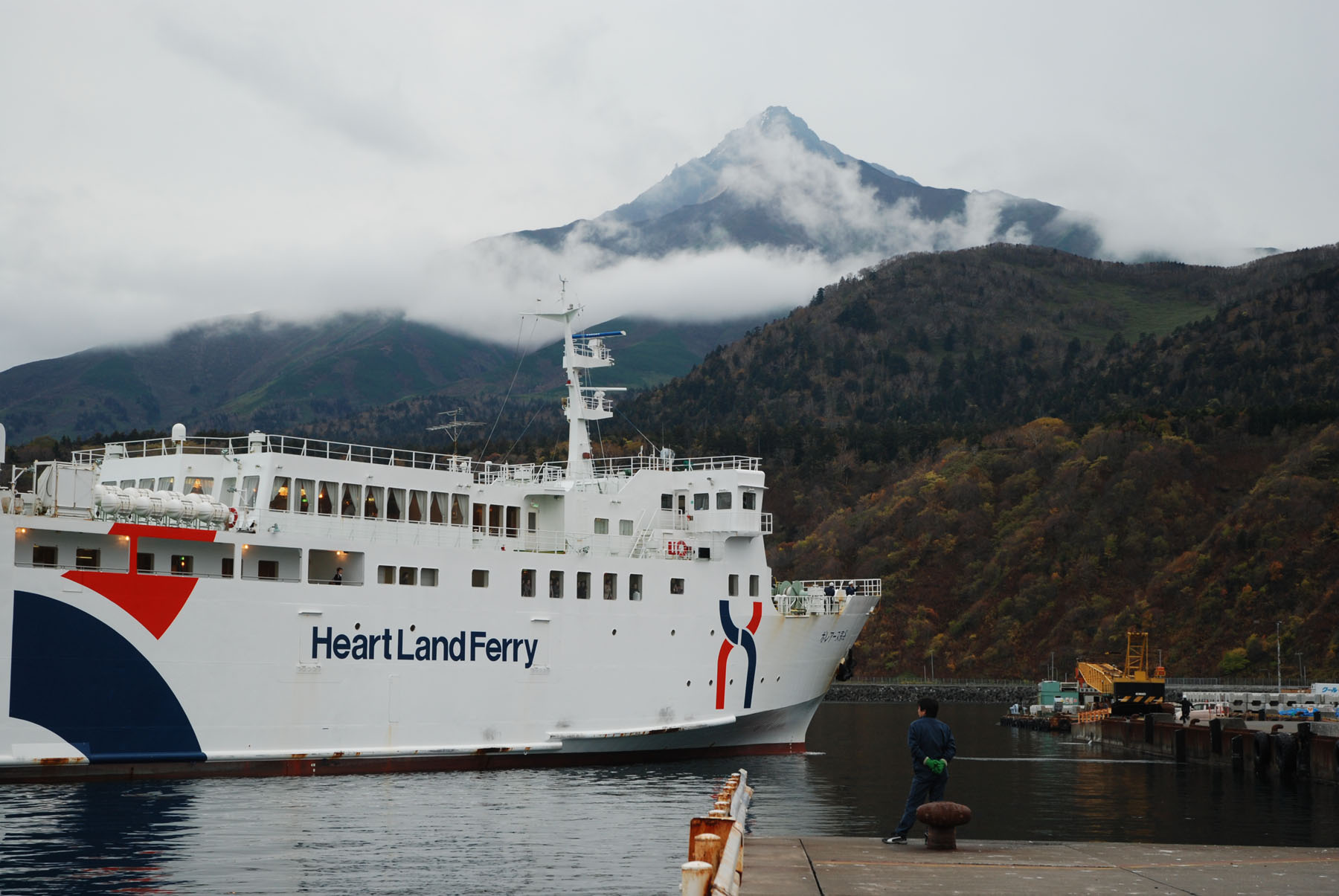
Our passage from Hokkaido to Rishiri was uneventful – just the way most people like their ocean travel to be. The Sea of Japan was calm as we stood out on the narrow, windy deck and watched the silhouette of Rishiri-Fuji grow larger and more detailed as we approached, commenting to each other that this was the same mountain peak Ranald set his sights upon as he struggled to maneuver his small, unwieldy boat closer to land on that long-ago July morning. There are, in fact, real similarities between the appearance of Rishiri-Fuji and Mt. Hood – the mountain of Ranald’s childhood – although whether this had any effect on Ranald [e.g., did he also see the resemblance between the two peaks?] only he himself could say. In my own humble opinion, by the time he got close enough to Rishiri Island to make out the details, I would venture that Ranald really didn’t care what Mt. Rishiri looked like – he simply wanted to find a place to safely “castaway”.
Mr. Eiji Nishiya, the dedicated and enthusiastic curator of the Rishiri Town Museum, met us when we docked – camera in hand, of course. [We know many good photographers, but I have to say that Mr. Nishiya takes his photography seriously, and I am always excited to open his newest emails to see what treasures he has sent us.] Mr. Nishiya took us on a brief drive along the ocean before delivering us to our initial destination – a modest western-style, “beachside” hotel that served breakfast and dinner and had its own in-house ‘onsen’. I’ve put the word “beachside” in quotation marks because, as far as I saw, there are no beaches on Rishiri Island, at least not the sandy kind; in fact, the shoreline reminded me very much of the Oregon Coast between the Sea Lion Caves and Seal Rock, where barely-eroded basalt flows meet the Pacific Ocean. Consequently, Rishiri felt very much like home to me [I grew up on the Oregon coast] and I spent much of the following days trying to convince Mr. Y. that it might be nice to immigrate to Rishiri sometime in the future. Even the storm that moved in overnight could not change my mind . . .
We were awakened the next morning by the sound of wind and rain against our window, but we are Oregonians and a little wind and rain is nothing to us. Mr. Nishiya was ready for us and by mid-morning we were happily rummaging through the Ranald MacDonald exhibit at the Rishiri Town Museum. All three of us were impressed by the number and quality of the exhibits, ranging from artifacts of the Ainu First Peoples to the subsequent influence of the Japanese who eventually displaced them, a creditable natural history exhibit of common and indigenous flora and [stuffed] fauna, a section devoted to the local industry of fishing and sea-farming and – of course – a well-placed and very well organized area devoted to none other than Ranald MacDonald. We could have easily and quite happily spent a few days examining Mr. Nishiya’s own private stash of MacDonald treasures, but arrangements had been made for Mr. Nishiya and Mr. Yatabe to give a brief presentation about Friends of MacDonald to the student body of one of the two island junior high schools – and we were all pleased and gratified that, once they had heard the incredible true story of Ranald MacDonald the First English Teacher in Japan, the kids were genuinely interested in and enthusiastic about “their” local hero.
Next we loaded into Mr. Nishiya’s car and drove around the whole, rocky island. Except for the difference in temperature [and the lack of palm trees!] I could have almost imagined myself on Maui, again because of the abundance of basalt and ancient lava flows. In fact, more than a few of the rocks had names – “Neguma no Iwa” [Sleeping Bear Rock] and “Jimmen Iwa” [The Rock Face] are just two examples. Mt. Rishiri is extinct – its last eruption is estimated to have been in 5830 BC – give or take 300 years – and erosion has produced an extremely rugged topography, but the wind and the waves have not yet been able to break all that basalt down into sand. This includes Notsuka Cove, where it is believed that Ranald first set foot on Rishiri; marginally protected from the elements, it is still used today by local fishermen. Like every other Pilgrim to that place, we stood and gazed out over the Sea of Japan and tried to imagine how it had been for him. And then, again like the others before me, I bent down to pick up a rock – to bring back to Toroda as an offering, perhaps? I found several, and even pocketed a couple, but something made me keep looking. I was soon rewarded by a flash of turquoise between the wet stones – a piece of glass float, broken and tumbled by the waves. Of course, Ranald never saw any glass floats while he was in Japan – Japan didn’t start using the glass floats until 1910.
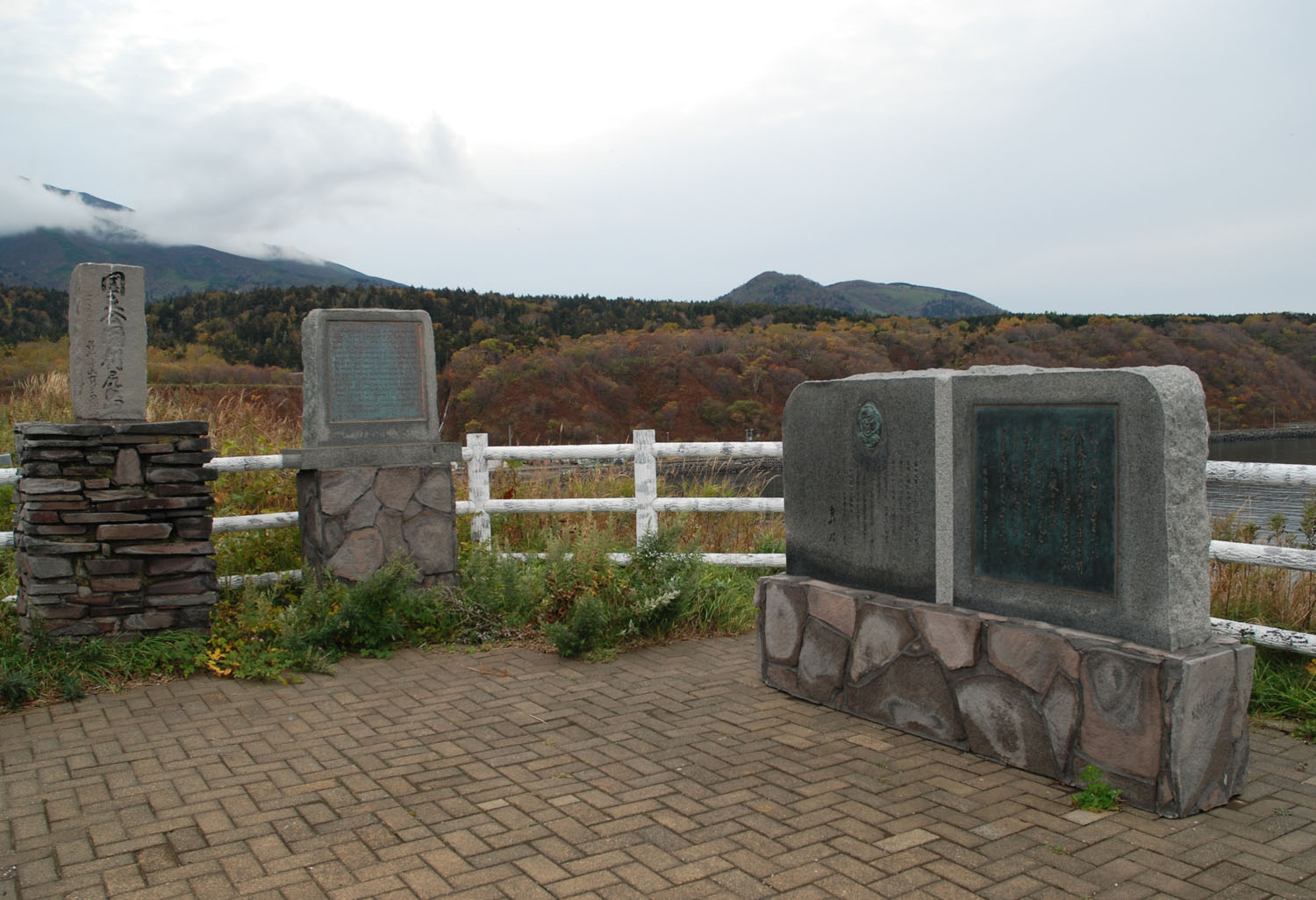
Before visiting Notsuka Cove we went to see the monuments memorializing Ranald’s exploits. The first has Ranald’s likeness and calligraphy of an excerpt from the novel “Umi no Sairei (海の祭礼)” (pub. 1986) by Akira Yoshimura (吉村 昭). The book became a sensation in Japan. There has been some confusion about the larger of the two monuments: in photos it looks as though there are two separate stones, but it is an illusion created by the way the granite is polished. This is, in fact, a single monument. The second monument on the left in the photo has the following inscription by Professor Emeritus of University of Hokkaido, Jyukichi Suzuki (鈴木重吉名誉教授) [Prof. Suzuki was born on Rishiri Island]:
“In 1848 ‘Kaei 1’ Ranald MacDonald born in Oregon reached ‘Notsuka’ pretending to be a shipwrecked sailar (sic). He felt deep racial connections with Japan across the Pacific although he knew of her total seclusion from the outside world. Inevitable he was arrested and sent to Nagasaki via Soya and Matsumae. During his imprisonment in Japan he did his best for mutual understanding and friendship between the two peoples transcending the language barrier. Five years later when Comm. Perry came to force open the closed doors of Japan, MacDonald’s former students at Nagasaki Einosuke Moriyama and others played an important role as interpreters. Thus Ranald enjoys the honor of being the first formal teacher of English and indirectly a father of modernizing Japan.”
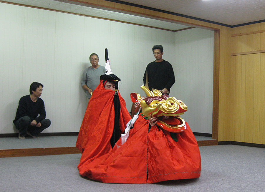 Later that evening we were treated to a very private practice session of a Kirin Shishi-Mai (麒麟獅子舞) conducted by some local residents, including Mr. Nishiya – who plays the Japanese bamboo flute. During a short break in the practice one of the men looked at us and grinned broadly. “No ferry tomorrow, too stormy!” he said with a laugh. “100% no ferry!” We all looked at each other in disbelief – would they actually cancel the only ferry back to Wakkanai? We had a plane to catch in Sapporo, and a tight itinerary to follow! Luckily we managed to get the last two seats in the very rear of the daily prop-jet flight from Rishiri Island to Sapporo [which, we later found out, is also frequently cancelled due to weather]. Sadly, we had to leave Mr. Yamazaki behind, promising that we would indeed drive down the western coast of Hokkaido with him on another day. . . Later that evening we were treated to a very private practice session of a Kirin Shishi-Mai (麒麟獅子舞) conducted by some local residents, including Mr. Nishiya – who plays the Japanese bamboo flute. During a short break in the practice one of the men looked at us and grinned broadly. “No ferry tomorrow, too stormy!” he said with a laugh. “100% no ferry!” We all looked at each other in disbelief – would they actually cancel the only ferry back to Wakkanai? We had a plane to catch in Sapporo, and a tight itinerary to follow! Luckily we managed to get the last two seats in the very rear of the daily prop-jet flight from Rishiri Island to Sapporo [which, we later found out, is also frequently cancelled due to weather]. Sadly, we had to leave Mr. Yamazaki behind, promising that we would indeed drive down the western coast of Hokkaido with him on another day. . .
Posted in Gates Ajar, Home | Comments Off on A pilgrimage …
January 31st, 2012
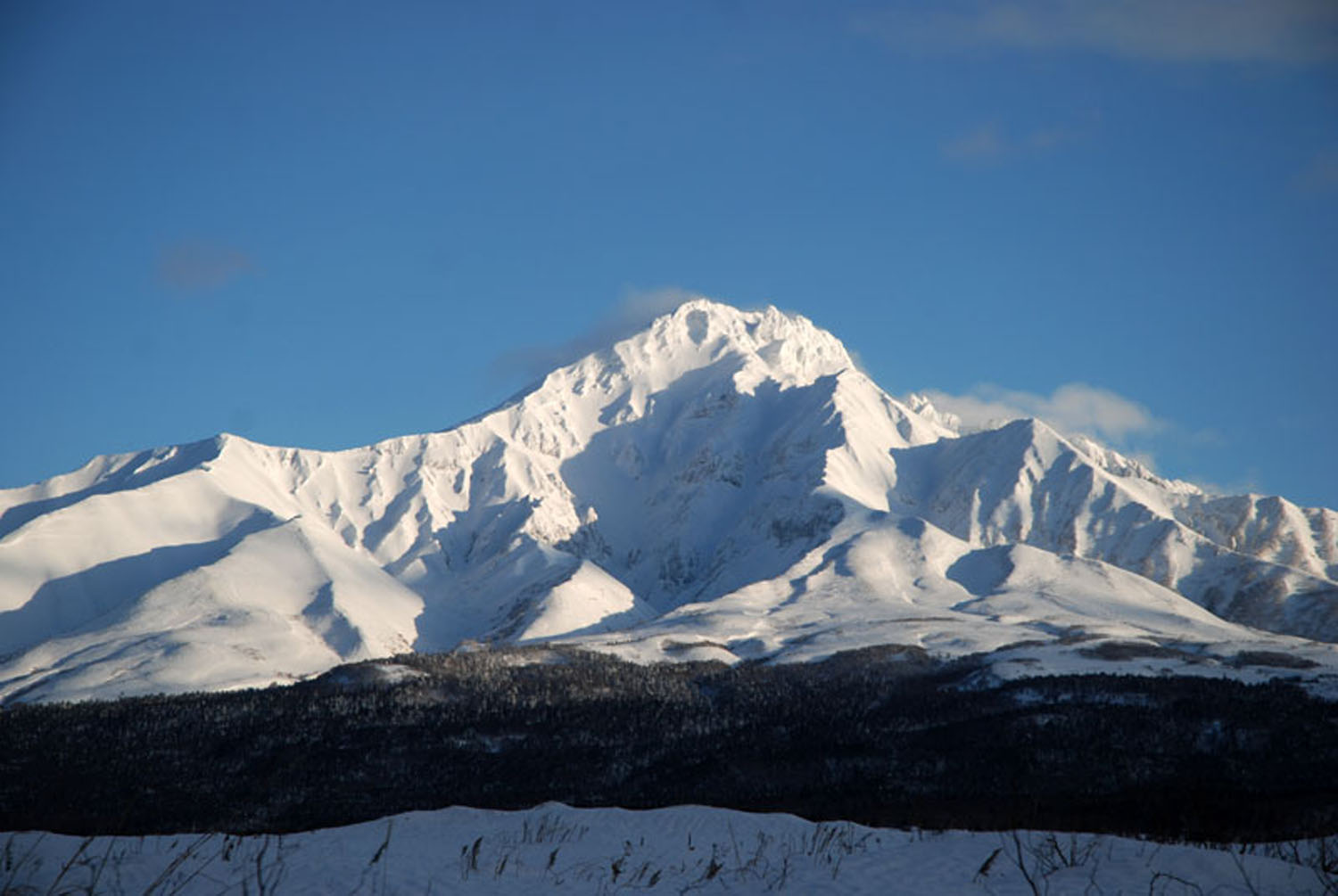
The last day of December 2011 – the day before the New Year of 2012 – the north wind blew off the cloud-cover over Mt. Rishiri and her rugged, snow-covered peaks appeared. The people of Rishiri turned toward our beloved mountain and gave thanks for another year of vigor and vitality.
辛卯・平成23年の大晦日. 利尻山にかかっていた雲を飛ばして秀麗の姿をあらわした。たくさんの元気をくれた利尻山に感謝.
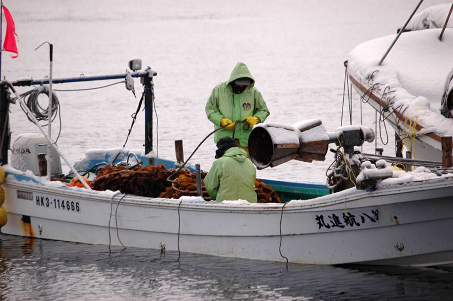
“Farming” konbu in the middle of winter on Rishiri.
Konbu can grow 3-10 meters long in two years on the coasts of Rishiri Island; it is harvested and sun dried before being shipped. Only Konbu which has matured for two years is used for cooking [one-year-old konbu, called ‘water konbu’, does not contain the rich components needed for a good flavor]. Konbu has been a part of the Japanese diet since ancient times, and Rishiri konbu is considered by most Japanese people to be the “best”.
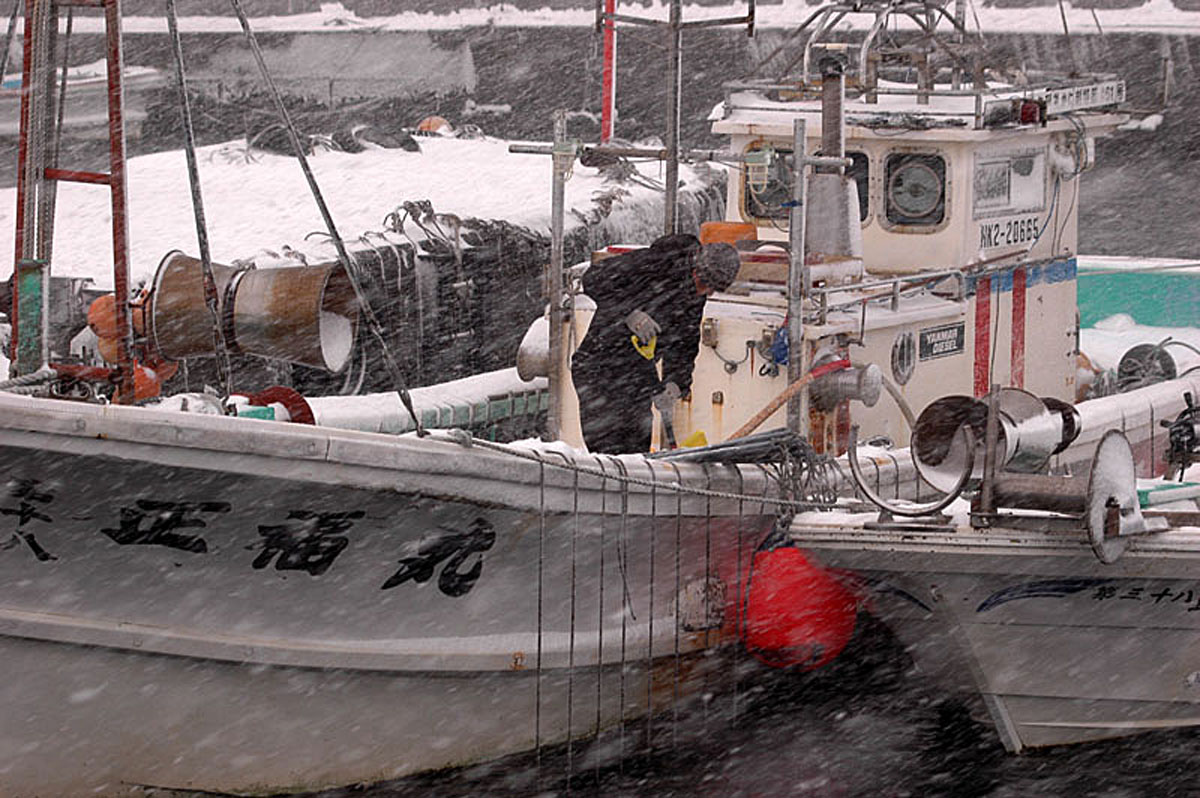
The winter winds blow from the northwest and bring snow to Rishiri. The north wind is called “ai” and the northwestern wind is called “tama“. When these winds blow, we on Rishiri Island exchange greetings: “”Shibareru ne?” – “It’s cold, isn’t it?” [A gross understatement, I think. ~A]
The cold is quite severe and penetrates through clothing to chill the skin. Still, it is necessary to remove the snow and ice from the boats, even on the coldest, most blustery days. There is never any rest for the fishermen of Rishiri.
北から北西の風が吹く利尻島. 北の風はアイ、北西の風はタマと言う。 この風が吹くと,「シバレルネ」が挨拶となる。 寒さが厳しく肌に凍みること。 吹雪いて船に積もった雪をとったり、時化で動かされる船を見たり,島人は真冬から船を守っている。
~ photos and comments by Eiji Nishiya
Posted in FOM Japan, Gates Ajar, Home | Comments Off on Rishiri Winter 2012
October 13th, 2011
秋の森。
野の花たちや草が枯れる秋は森の中に入りやすくなる。
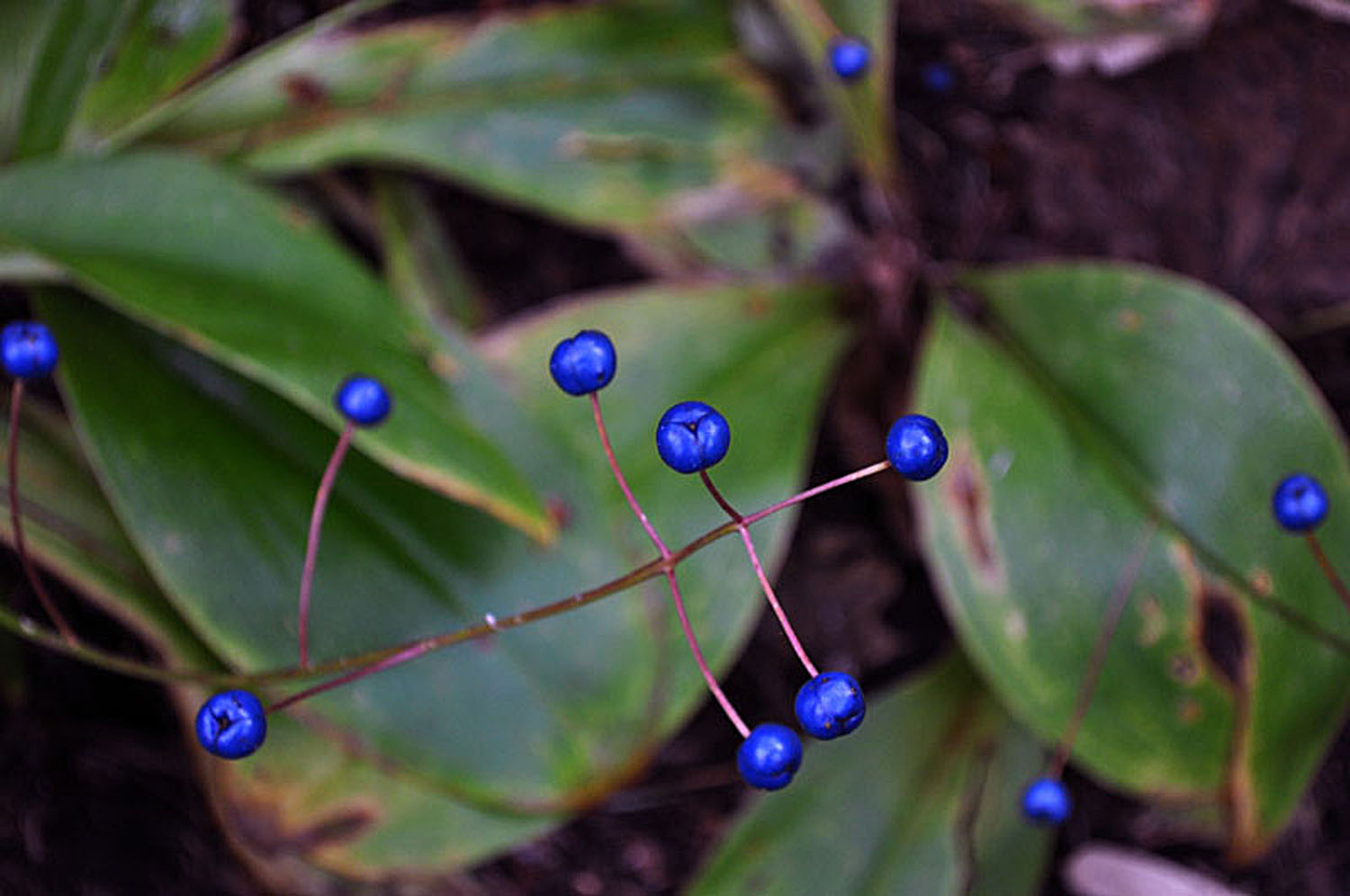
ツバメオモトの青い実をたくさんみつけた。
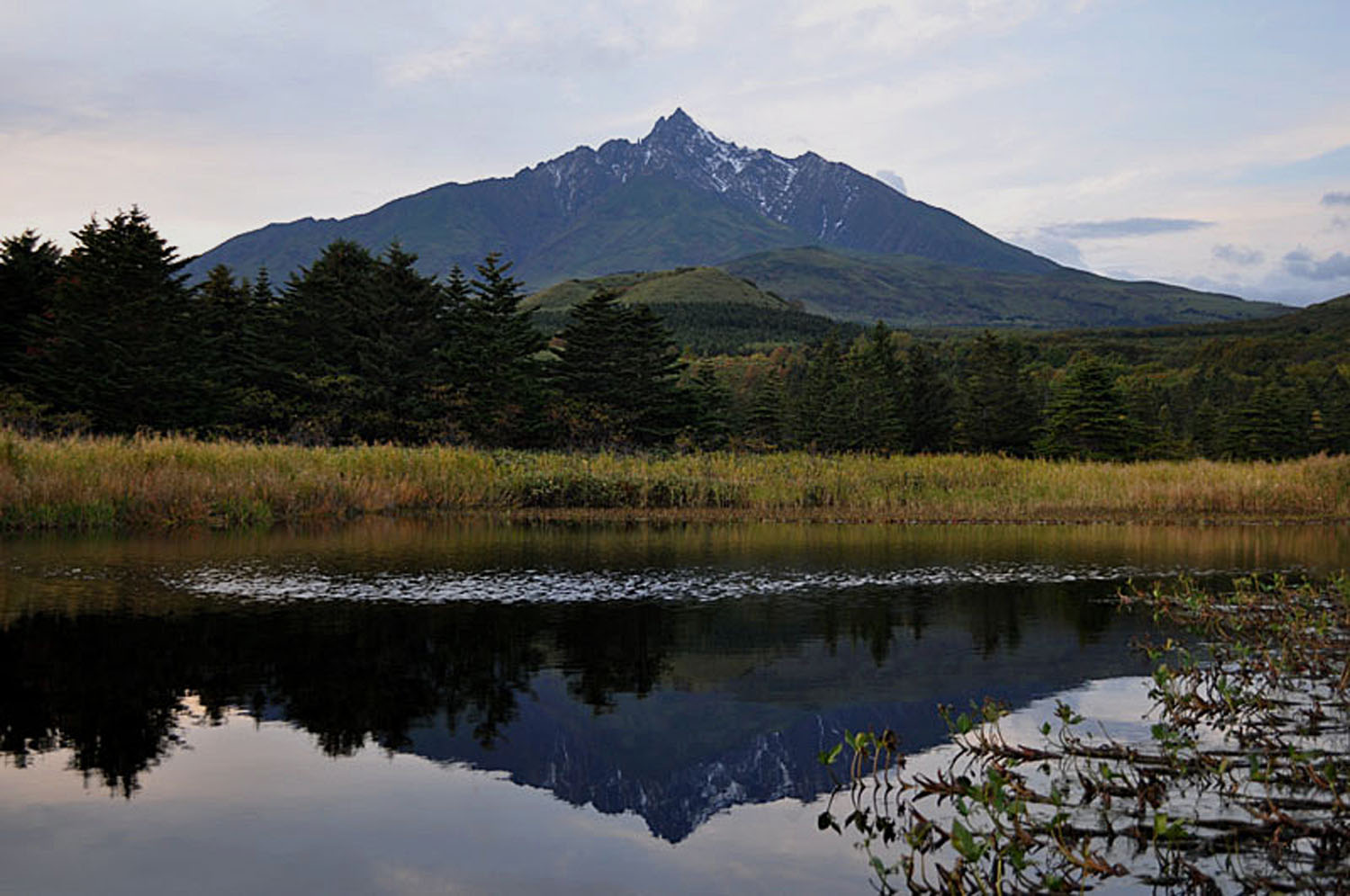
夕方、曇り空でもメヌショロ沼に利尻山が映った。
秋晴れの日。
利尻山頂がきれいに見えたこと。
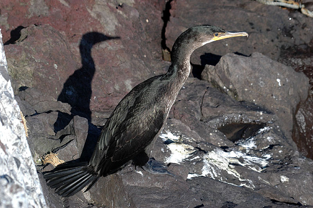
岩場のウミウは陽射しで日向ぼっこしていた。
The forest in autumn …
It gets easier to walk into the forest when the flowers and the weeds have withered;
I found a lot of tsubame-omote there having blue fruit/seeds.
In the early evening, despite the cloudy sky, Mt. Rishiri reflected on Lake Nushoro.
Under the autumn sky the top of Mt. Rishiri could be clearly seen as the Sea- cormorants basked in the last rays of sun on the rocky shores.
tsubame-omoto [ ‘blue-fruit-plant’ ] – Japanese Wood Lily – Clintonia Udensis
photos by Eiji Nishiya
Posted in FOM Japan, Gates Ajar, Home | Comments Off on Rishiri ~ Autumn 2011
September 15th, 2011
Clark’s Dismal Nitch
In 1803, Thomas Jefferson dispatched Captains Meriwether Lewis and William Clark to lead the Corps of Discovery on a mission to find a water route across North America and explore the natural resources of the uncharted American West. Little did Lewis and Clark realize that the time they would spend on the shores of the lower Columbia River would be counted among the most discouraging, dangerous, and disagreeable experiences faced during their expedition.
Imagine this: it’s early 1805, the fresh food had run out. The clothes were literally rotting off the backs of the members of the Corps of Discovery. They were traveling as fast as they could down the Columbia River, hoping to meet one of the last trading ships of the season. If they made it, they’d send a set of journals and some collections home as requested by President Jefferson. But foremost was the chance to use an unlimited letter of credit from the president, a chance to “charge” all the goods the tired explorers needed [plus perhaps get a little rum] from the trade ship.
What the Corps didn’t realize, however, was that it was about to run into some of the journey’s most treacherous moments. A fierce winter storm forced the Corps off the river and pinned the group to a north shore cove consisting of little more than jagged rocks and steep hillside. On November 10th, as the party paddled past Grays Point, they saw that the steep, forested shoreline consisted of a series of coves, or “nitches”, each divided from the next by a small point of land. They passed present-day Dismal Nitch (also known as Megler Cove), but as the weather again worsened, the party retreated to a sheltered cove upriver from the Dismal Nitch, [approximately 600 feet north / northeast of the eastern end of the present-day “Dismal Nitch Safety Rest Area”].
Rain soaked the expedition party that night, and it continued at intervals throughout the next day, November 11, 1805. Conditions worsened on November 12th; on top of rain, wind and cold came thunder, lightning and hail. Clark describes their move from the unnamed cove to the Dismal Nitch:
“As our situation became Seriously dangerous, we took the advantage of a low tide & moved our Camp around a point a Short distance to a Small wet bottom at the mouth of a Small Creek (Megler Creek), which we had observed when we first came to this cove…”
The rain continued on November 13 and 14. For only the second time in the expedition, Clark said he was concerned for the safety of the Corps. “A feeling person would be distressed by our situation,” he wrote in wet misery, as the expedition became in danger of foundering just within a few miles of its destination – the Pacific Ocean. Finally, the storm broke and allowed the group to move on. It missed the trading ship, but eventually achieved its exploration goals. On the morning of November 15 Clark awoke to calm weather for the first time in 10 days. Clark describes the party’s escape from what became known as “the Dismal Nitch”:
“About 3 oClock the wind lulled and the river became calm, I had the canoes loaded in great haste and Set Out, from this dismal nitich where we have been confined for 6 days…”
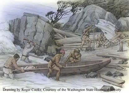
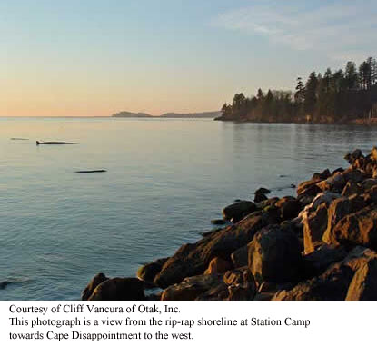
Although the Corps met “near disaster” at Dismal Nitch, they arrived “in full view of the ocian” at Station Camp. [It was at Station Camp that the famous vote was taken that included all members of the party and the party decided to move the south shore of the Columbia River where they would spend the winter before beginning their long journey home: more about this later.] However, both before and after Captains Lewis and Clark established Station Camp, the site was a vital and thriving Chinook Indian village. The Corps spent just 10 days here, but used Station Camp as a departure point for an overland trek to their first view of the Pacific Ocean and an exploration of the area. Together with nearby Dismal Nitch, Station Camp helps greatly to tell the Lewis and Clark story in Washington – and the ultimate effect the Corps of Discovery had upon the indigenous First peoples of the Pacific Northwest.
For thousands of years, the Chinook people have lived along the Columbia River and their home near the river’s mouth was strategically located to provide abundant food, such as salmon and shellfish. In addition, the nearby forests were home to game animals and the grasslands and marshes provided ample materials for making shelter, clothing and trade and household goods. The river provided a way for Chinook traders to travel to the south shore and up and down the Columbia.
Generations before the White Explorers came, the Chinook had already developed a sophisticated, rich culture and enjoyed great success as traders. The waterway near Station Camp became a virtual trade “water highway.” During the 10 years before Lewis and Clark arrived overland at this spot, almost 90 trade ships from Europe and New England are documented to have crossed the Columbia River Bar to trade with Native Americans. These ships brought metal tools, blankets, clothing, beads, liquor and weapons to trade for beaver and sea otter pelts. By the time the Corps reached the site, the Chinook’s had moved to their winter village and this village was unoccupied. The explorers spent almost two weeks there.
Several significant events took place, including the decision to spend the winter across the river, in what is now Oregon. It was Nov. 24, 1805, and the explorers desperately needed to lead the Corps to a winter campsite, one rich with game and near friendly tribes who would trade for supplies. A majority of the Corps, including the Indian woman Sacagawea and the African American York decided to cross the Columbia River to look for such a place. Because of this poll and decision, some historians call Station Camp “the Independence Hall of the American West.” It would be more than fifty years before African Americans could vote, and more than 100 years before the right was extended to women.
History of “Dismal Nitch”
The Dismal Nitch area is located within the traditional territory of the lower Chinookan people. Through common usage, the term Chinook has come to refer to all speakers of the Chinook language family who inhabited the territory from the mouth of the Columbia River upstream to The Dalles and along the lower Willamette River to present-day Oregon City.
Of the many Chinook villages along the north shore of the Columbia River, two known summer villages were located in the vicinity of the Dismal Nitch. Approximately 1.25 miles southwest of the Dismal Nitch was Qaiitsiuk, later called Chinookville or Chenook, just west of present-day Point Ellice. The Lower Chinook were known for their canoe-building prowess, and their vessels helped them establish their reputation as traders well before Europeans set eyes on the region.
The Lower Chinook were first described in writing by Captain Robert Gray, who sailed into the mouth of the Columbia River in 1792, and by Captain George Vancouver, who also sailed into the area that year. By the time Lewis and Clark descended the river in the fall of 1805, the presence of Europeans on the lower Columbia River was not uncommon.
Today, the Chinook Indian Nation is made up of five separate tribes, including the Chinook, the Willapa, the Clatsop, The Kathlamets, and the Wahkiakum. All five tribes are Chinookan speakers.
The State of Washington is developing a park at Middle Village – Station Camp, focusing on the Chinook history, as well as telling the story of the Corps’. In 2005, archeologists found abundant physical evidence to support the importance of the site as a Chinook trade village. More than 10,000 artifacts were uncovered, including trade beads, plates, cups, musket balls, arrowheads, Indian fish net weights and ceremonial items. The European artifacts are from both before and after the Corps’ visit in 1805, and attest to the vitality of the Chinook social and economic life at the site. Station Camp eventually will encompass about 280 acres and be operated by the Lewis and Clark National and State Historical Parks.
~ ~ ~ ~ ~
Station Camp http://www.nps.gov/lewi/planyourvisit/stationcamp.htm
History of "Dismal Nitch” http://www.nps.gov/lewi/planyourvisit/dismal.htm
Posted in Gates Ajar, Home | Comments Off on Station Camp and Clark’s Dismal Nitch
|
 |
|